The following eBooks are available to download for a small fee which helps pay for the running costs of the site. Please ensure that the email address entered is correct as the link to download the book will be sent by email on completion of the transaction.
14 Days in Brittany

14 Days Touring Brittany
The first thing that you notice about Brittany is a sense of age – most villages have 300+ year old houses, 500+ year old churches, and maybe a 5000-year old standing stone.
Over the last 3000 years, nine different groups – from Neolithic tribes and Gauls, through Romans and Celts, to Bretons and Franks – have left their mark on its landscape, architecture and social history. The result is a unique language, cuisine and culture that is as Celtic as French.
Through this rich and historic landscape, touring routes have been constructed that are gentle enough for family groups, yet with plenty to interest seasoned tourers; easily accessible by ferry from the UK.
This book covers a 14 Day trip starting in Roscoff and finishing in Saint-Malo undertaken in the summer of 2022. It includes descriptions of the sights of the main villages and towns on the national routes and ideas for diversions to historic places close by.
A limited number of full-colour printed copies of this book, 142 pages, A5 format, are available – click on the button below to enter your postal details and purchase a copy. Note that postage is UK only – for other countries please contact me directly.
Lakeland Gravel
Each of my Lakeland Gravel routes are available to download as an individual double-sided A4 sheet, designed to be folded into an A6 leaflet with the map for the route on one side and the description, together with points of interest on the other.
Alternatively, a 72-page A6 eBook can be purchased and downloaded with all 7 routes in it, more pictures and history. An extract of the text is available to view.

Lakeland Gravel West
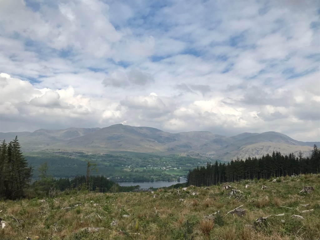
Gravel biking comes into its own in the Southern Lake District in an area bounded by Grasmere and Ambleside to the north, Windermere to the east, Newby Bridge to the south and Wainwright’s Southern Fells (Old Man of Coniston and Bowfell) to the west.
Away from the high fells, it is criss-crossed by quiet tarmac lanes and its fair share of hard-packed and gravel tracks. This guide covers seven rides starting from Ambleside, but also accessible from Hawkshead and Coniston, together with the history and geography of the areas they traverse.
A limited number of full-colour printed copies of this book are available, 72 pages, A6 format, – click on the button below to enter your postal details and purchase a copy. Note that postage is UK only – for other countries please contact me directly.
Route 1. Sawrey and Windermere
Distance: 29.4km, Ascent: 311m
This is the smoothest of the routes and an easy day out. There are many refreshment opportunities on route, including in Hawkshead, the fisheries at Esthwaite Water and the National Trust cafes at Claife Heights and Wray Castle. The only significant climbs are up to Skelwith Fold and a short section alongside Windermere.
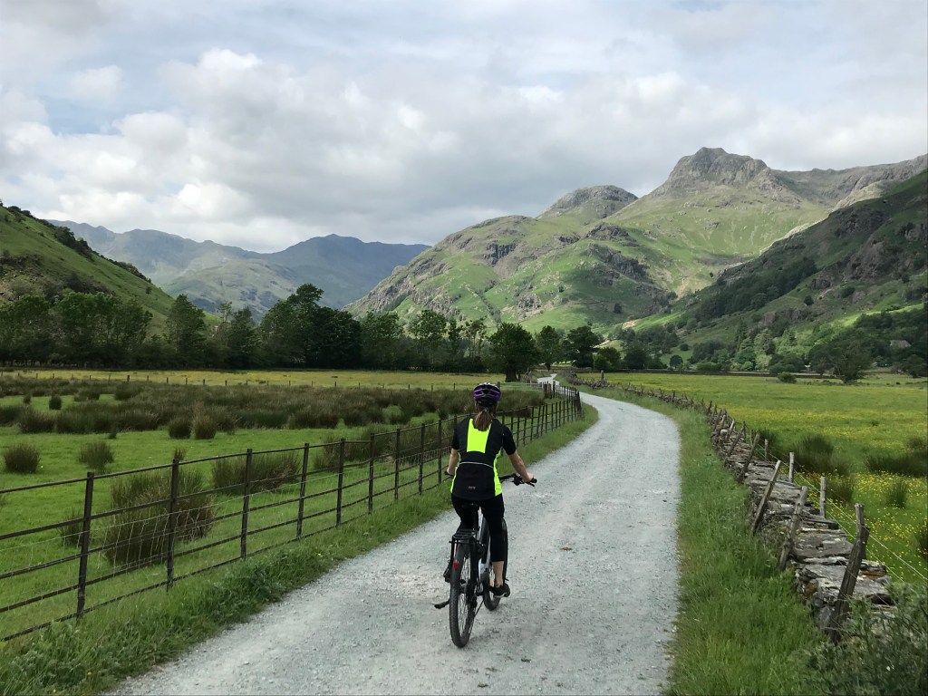
Route 2. Great Langdale, Dungeon Ghyll and Grasmere
Distance: 26.6km, Ascent: 363m
This is my favourite route, as it heads deep into the mountains with spectacular views and beautiful woods. It also passes three of the most picturesque lakes – Elterwater, Grasmere and Rydal Water. Again there are cafes at Skelwith Bridge and Elterwater, plus the National Trust at Sticklebarn. There are also a number of pubs. There are several steep climbs – up to Skelwith Bridge, out of Elterwater through the quarries and the climb over Red Bank to Grasmere.
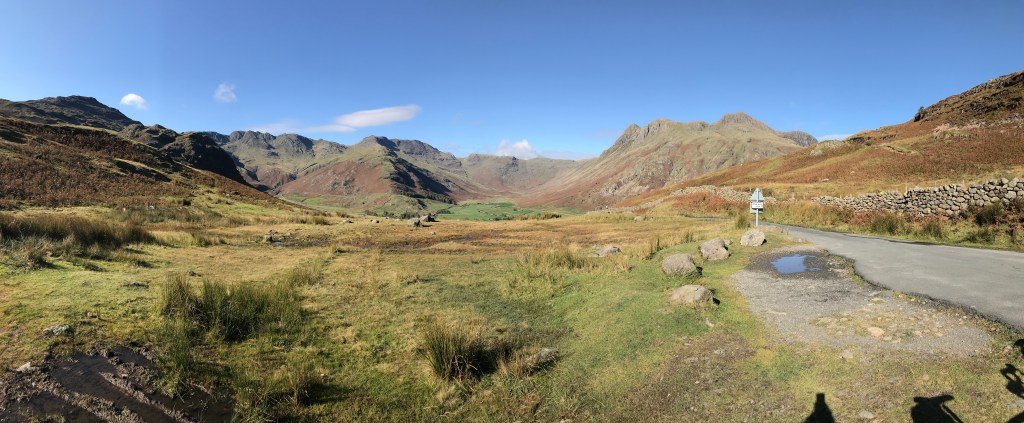
Route 3. Blea Tarn and the Langdales
Distance: 29.7km, Ascent: 522m
A harder option than Route 2 to get to Dungeon Ghyll via Little Langdale, this includes a steep gravel track from the River Rothay at Colwith and then the road climb over Blea Tarn Col. The reward from the top is a spectacular view over the Langdale Pikes before a steep twisting descent into the valley. Refreshments at Dungeon Ghyll.
Route 4. Tarn Hows and Coniston
Distance: 32.2km, Ascent: 496m
One of the most technical rides of this selection given the steep descent from Tarn Hows to Coniston Water, although this can be missed out by following the exit route from the National Trust car park. Apart from that, it includes a significant proportion of lovely gravel tracks through the old mine workings of the Tilberthwaite valley and a pleasant finish back from Elterwater reversing Route 2. There are cafes in Coniston and Elterwater and steeper climbs to Tarn Hows and to Skelwith Fold.
Route 5. Grizedale Forest West and Hawkshead
Distance: 35.2km, Ascent: 549m
Grizedale Forest is a major centre for mountain biking and there are a number of purpose built single-track trails to test out devotees. However there are also a wide range of waymarked forest tracks suitable for gravel bikes. This route uses the main loop in the western half of the forest, before heading back to Hawkshead and Ambleside. There are refreshments in the forest centre as well as in Hawkshead.
The route reaches the highest point of those described here, hence the climbs are sustained, albeit steady and the views across to the Coniston Fells make them worthwhile. The steeper climbs are actually on the lower slopes above the forest centre – with a corresponding steep descent down to it, and also crossing the ridge from Hawkshead to Wray, with a particularly steep descent down to Blelham Tarn.

Route 6. Claife Heights and Windermere
Distance: 27.2km, Ascent: 334m
The top of Claife Heights provides varied cycling – a mixture of woods, grassy tracks, and sometimes short rocky sections which non-technical riders may have to push across, however this compensated for by glorious views over its tarns to the Langdale Pikes. Aside of this section, it includes a significant proportion of lovely gravel tracks along NCN 6 to Wray and then climbing up through the woods below Latterbarrow. There is also a pleasant finish back along the shores of Windermere. There is a National Trust cafe at the Claife Viewing Station and steeper climbs up onto Claife Heights.
Route 7. Grizedale Forest East and Sawrey
Distance: 42.8km, Ascent: 800m
Grizedale Forest is a major centre for mountain biking and there are both purpose built single-track trails and a wide range of waymarked forest tracks suitable for gravel bikes. This route uses the main loop in the eastern half of the forest, with great views looking north to the fells above Ambleside and also south to the coast. It is both the longest of these routes and also has the most ascent as the forest trails undulate through the forest. There is a cafe at the Esthwaite Water fisheries and several short steeper climbs in Grizedale Forest as well as climbing back up Dale Park.
A limited number of printed copies of these guides are available – printed double-sided in colour onto a waterproof A4 sheet- click on the button below to enter your postal details and purchase. Note that postage is UK only – for other countries please contact me directly.
